Awarded in the 2024–2025 edition of Eramet’s Open Innovation Biodiversity Challenge, British start-ups Mozaic Earth and Gentian conducted a field case study in Gabon. The objective: to test, under real-world conditions, AI-based biodiversity assessment solutions designed to provide reliable ecological indicators of ecosystem health.
Two complementary areas of expertise serving biodiversity
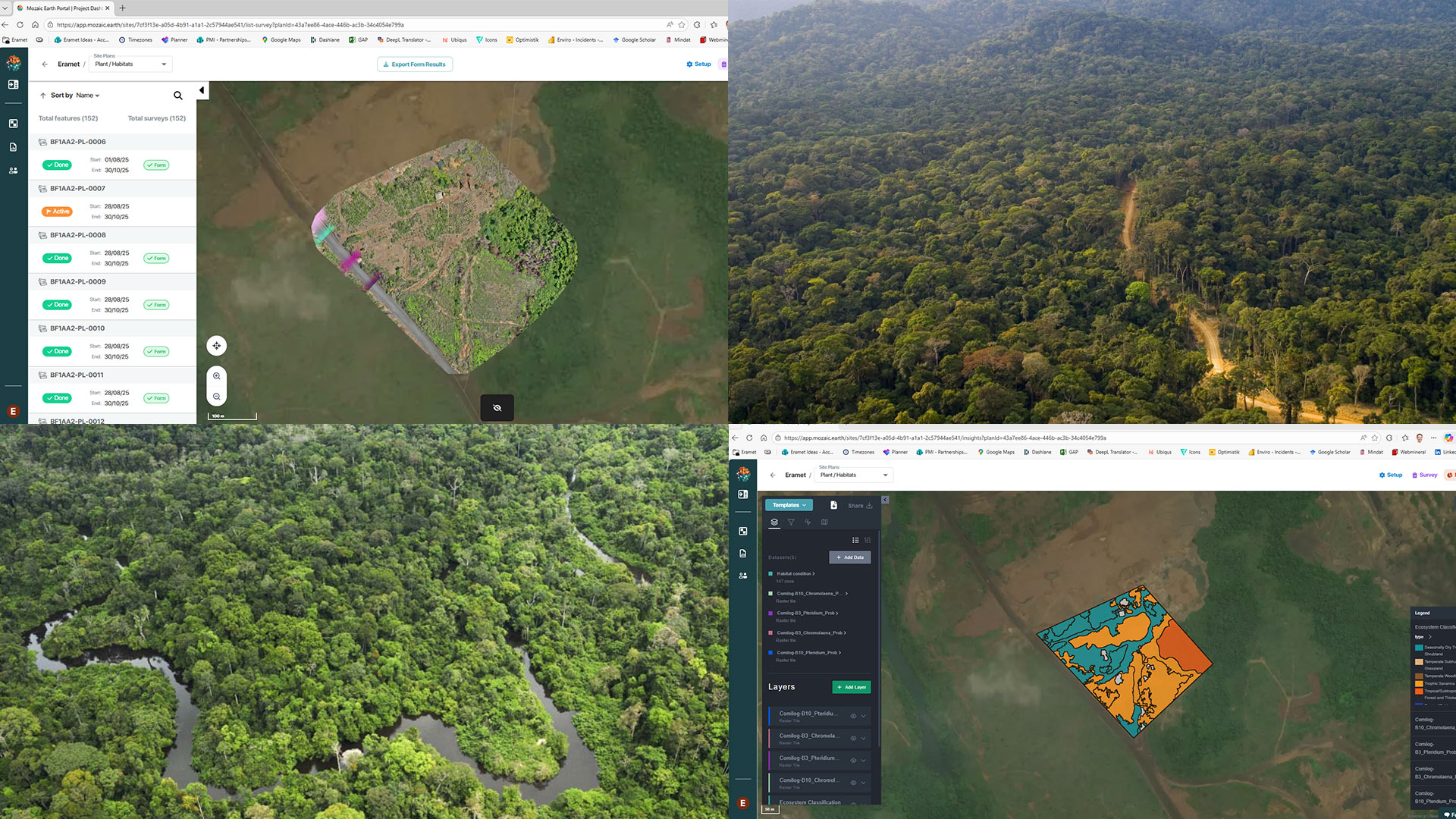
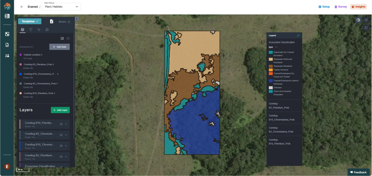
The two start-ups combined the best of their expertise. Gentian leverages its capabilities in high-resolution satellite data analysis and drone imagery to train an artificial intelligence model that assesses habitats at scale. Meanwhile, Mozaic Earth has developed an online platform to centralize, visualize, and analyze species present in a given environment using all types of data collected via drones, satellites, or ground photography.
As part of the case study, a sample of collected data was validated by ecologists, with support from the National Herbarium of Gabon, ensuring reliable species identification and AI model training.
The uniqueness of this solution lies in the combination of aerial data and field observations. Whereas previously tested solutions relied on a single type of data—with limitations either in scientific validation or large-scale coverage—this approach leverages the strengths of each method.
A field test in Gabon
Conducted between September and December 2025, in close collaboration with Eramet Comilog and the Lékédi Biodiversity Foundation, the study covered five plots: two within the Foundation in Bakoumba (one natural savanna plot and one regenerating savanna) and three in Moanda, representing different stages of post-mining rehabilitation.
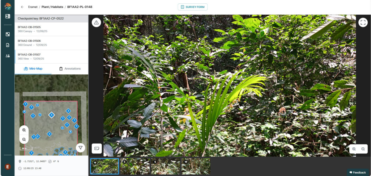
Gentian collected and processed satellite data, complemented by drone imagery offering the resolution needed for species identification. At the same time, Mozaic Earth conducted ground photo campaigns with local teams trained to use its platform.
A “Google Earth” for biodiversity
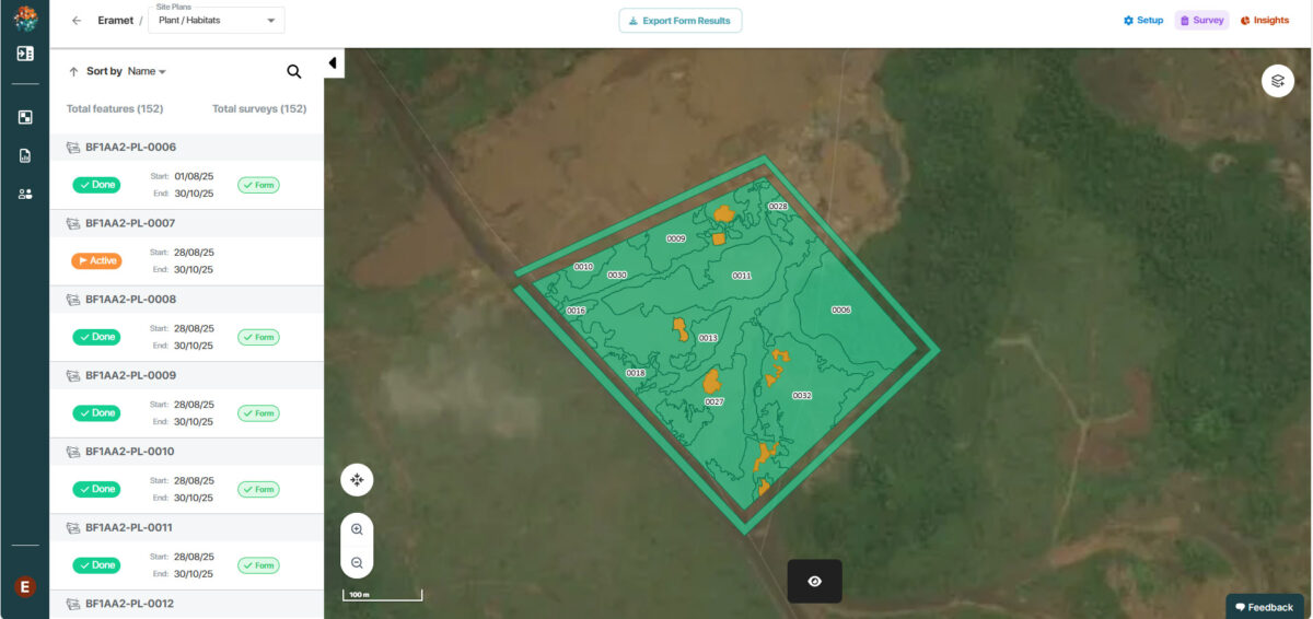
All collected data were integrated into a platform comparable to a “Google Earth” for biodiversity. It enables users to navigate across studied sites and overlay different layers of information such as species inventories and biodiversity indicators.
To assess the ecological condition of the plots, the start-ups relied on recognized environmental standards, particularly the Wallacea Trust methodology. This approach makes it possible to evaluate and compare the relative ecological quality of the studied plots, identify their vulnerabilities, and monitor their evolution over time.
Highly encouraging results for the future
This study confirms the potential of a long-term monitoring tool capable of measuring biodiversity restoration at rehabilitated sites, assessing the health of planted species, and detecting recolonization by non-planted species—including invasive alien species that may require specific actions. This represents a key step in evaluating the environmental impact of our actions, as the solution helps accelerate decision-making to continuously adapt site rehabilitation strategies.
This platform could help strengthen the Group’s environmental transparency. It opens the way to structured and reliable external sharing of ecological data—an increasing requirement in the mining sector. The solution developed by Mozaic Earth and Gentian for Eramet Comilog and the Lékédi Biodiversity Foundation could be extended to other Group sites.